Geolocate

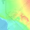
At Tur topographic map

Click on the map to display elevation.

About this map
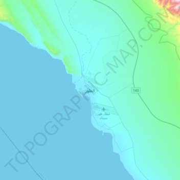
Name: At Tur topographic map, elevation, terrain.

Location: At Tur, South Sinai, 46511, Egypt (28.08167 33.46361 28.40167 33.78361)

Average elevation: 83 m

Minimum elevation: 0 m

Maximum elevation: 1,394 m

Other topographic maps

Click on a map to view its topography, its elevation and its terrain.
Ras Sudr

Egypt > South Sinai

Average elevation: 17 m

Ras Muhammad National Park

Egypt > South Sinai

Average elevation: 112 m

Abu Galum Protectorate

Egypt > South Sinai

Average elevation: 632 m

Ras Sudr

Egypt > South Sinai

Average elevation: 17 m

Al Tour City

Egypt > South Sinai

Average elevation: 50 m

Wadi Khuraytah

Egypt > South Sinai > Saint Catherine

Average elevation: 1,323 m

Gear up for your next adventure:

🐕Hiking Dog Harnesses - Rugged harnesses for taking your companion on mountain trails
🔋Lithium AA Batteries - Long-lasting power that performs well in cold mountain weather
🐕Dog Hiking Gear - Equipment for hiking safely with dogs
🧴Tick Removal Tools - Small, essential health tool for UK woodland and moorland
📍Handheld GPS Navigators - Reliable satellite navigation for hiking and off-road exploration

As an Amazon Associate, this site earns from qualifying purchases at no extra cost to you.