
Make a donation
Gear up for your next adventure:
As an Amazon Associate, this site earns from qualifying purchases at no extra cost to you.
Malay Peninsula topographic map
Click on the map to display elevation.
Make a donation
Gear up for your next adventure:
As an Amazon Associate, this site earns from qualifying purchases at no extra cost to you.
Malay Peninsula
The Kangar-Pattani floristic boundary crosses the peninsula in southern Thailand and northernmost Malaysia, marking the boundary between the large biogeographic regions of Indochina to the north and Sundaland and Malesia to the south. The forests north of the boundary are characterized by seasonally-deciduous trees, while the Sundaland forests have more year-round rainfall and the trees are mostly evergreen. Peninsular Malaysia is home to three terrestrial ecoregions. The Peninsular Malaysian montane rain forests ecoregion covers the mountains above 1000 meters elevation. The lowlands and hills are in the Peninsular Malaysian rain forests ecoregion. The Peninsular Malaysian peat swamp forests include distinctive waterlogged forests in the lowlands on both sides of the peninsula.
Make a donation
Gear up for your next adventure:
As an Amazon Associate, this site earns from qualifying purchases at no extra cost to you.
About this map
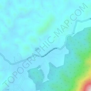
Name: Malay Peninsula topographic map, elevation, terrain.
Location: Malay Peninsula, 64, Benta, Lipis, Pahang, Malaysia (3.99995 101.99995 4.00005 102.00005)
Average elevation: 131 m
Minimum elevation: 78 m
Maximum elevation: 538 m
Make a donation
Gear up for your next adventure:
As an Amazon Associate, this site earns from qualifying purchases at no extra cost to you.