
Lose Hill topographic map
Interactive map
Click on the map to display elevation.
About this map
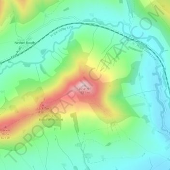
Name: Lose Hill topographic map, elevation, terrain.
Average elevation: 265 m
Minimum elevation: 172 m
Maximum elevation: 472 m
Other topographic maps
Click on a map to view its topography, its elevation and its terrain.
Hadfield
United Kingdom > England > Derbyshire > High Peak
Hadfield, High Peak, Derbyshire, England, United Kingdom
Average elevation: 174 m
Mam Tor
United Kingdom > England > Derbyshire > High Peak
Mam Tor, High Peak, Derbyshire, East Midlands, England, S33 8WA, United Kingdom
Average elevation: 347 m
Buxton
United Kingdom > England > Derbyshire > High Peak
Buxton, High Peak, Derbyshire, England, United Kingdom
Average elevation: 334 m
Castleton
United Kingdom > England > Derbyshire > High Peak
Castleton, High Peak, Derbyshire, England, United Kingdom
Average elevation: 326 m