Geolocate

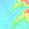
Assumption topographic map

Click on the map to display elevation.

About this map

Name: Assumption topographic map, elevation, terrain.

Location: Assumption, Koronadal, South Cotabato, Soccsksargen, Philippines (6.35177 124.81203 6.46425 124.87037)

Average elevation: 267 m

Minimum elevation: 70 m

Maximum elevation: 808 m

Other topographic maps

Click on a map to view its topography, its elevation and its terrain.
Quezon Range

Philippines > South Cotabato > Koronadal

Average elevation: 239 m

Quezon Range

Philippines > South Cotabato > Koronadal

Average elevation: 239 m

Siok

Philippines > South Cotabato > Koronadal > Mabini

Average elevation: 131 m

Gear up for your next adventure:

👟Men's Trail Running Shoes - Lightweight grip for fast movement over topographic contours
👟Women's Trail Running Shoes - Agile footwear for fell running and technical trails
🗺️Topographic Maps - Detailed maps showing elevation and terrain features
🧺Microfibre Travel Towels - Fast-drying and compact towels for wild swimming and camping
🔥Reusable Hand Warmers - Maintain dexterity in your fingers for precise map handling

As an Amazon Associate, this site earns from qualifying purchases at no extra cost to you.