
Thank you for supporting this site ❤️
Make a donation
Make a donation
Gear up for your next adventure:
As an Amazon Associate, this site earns from qualifying purchases at no extra cost to you.
Momberg topographic map
Click on the map to display elevation.
Thank you for supporting this site ❤️
Make a donation
Make a donation
Gear up for your next adventure:
As an Amazon Associate, this site earns from qualifying purchases at no extra cost to you.
About this map
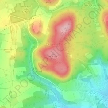
Name: Momberg topographic map, elevation, terrain.
Location: Momberg, Oberthal, Landkreis St. Wendel, Sarre, 66649, Alemania (49.52249 7.05758 49.52259 7.05768)
Average elevation: 410 m
Minimum elevation: 323 m
Maximum elevation: 512 m
Thank you for supporting this site ❤️
Make a donation
Make a donation
Gear up for your next adventure:
As an Amazon Associate, this site earns from qualifying purchases at no extra cost to you.