Geolocate

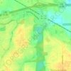
Southern Meadows topographic map

Click on the map to display elevation.

About this map

Name: Southern Meadows topographic map, elevation, terrain.

Location: Southern Meadows, Montgomery, Montgomery County, Alabama, 36105, United States (32.31403 -86.33469 32.35403 -86.29469)

Average elevation: 61 m

Minimum elevation: 46 m

Maximum elevation: 81 m

Other topographic maps

Click on a map to view its topography, its elevation and its terrain.
Gear up for your next adventure:

📷Outdoor Action Cameras - Cameras designed for hiking and adventure
👖Convertible Hiking Trousers - Versatile zip-off pants for changing mountain weather conditions
🌦️Portable Weather Meters - Handheld tools for monitoring weather conditions
🥾Women's Waterproof Hiking Boots - High-performance trekking boots designed for all-weather comfort
👕Merino Base Layers - Natural temperature regulation for cold weather hiking and camping

As an Amazon Associate, this site earns from qualifying purchases at no extra cost to you.