
Ramhurst topographic map
Click on the map to display elevation.
About this map
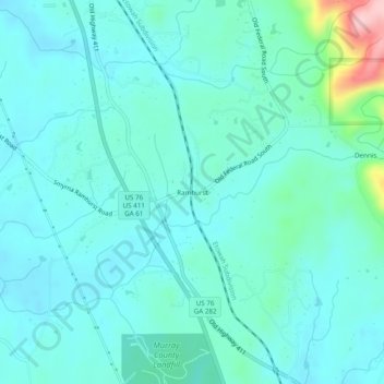
Name: Ramhurst topographic map, elevation, terrain.
Location: Ramhurst, Murray County, Georgia, United States (34.67814 -84.75077 34.71814 -84.71077)
Average elevation: 245 m
Minimum elevation: 212 m
Maximum elevation: 423 m
Other topographic maps
Click on a map to view its topography, its elevation and its terrain.
Chatsworth
United States > Georgia > Murray County
Chatsworth is located in central Murray County at 34°46′20″N 84°46′44″W / 34.77222°N 84.77889°W / 34.77222; -84.77889 (34.772336, -84.778977), in northwestern Georgia. It sits at an elevation of 750 feet (230 m) on the west side of the valley of Holly Creek, with 2,840-foot (870 m) Fort…
Average elevation: 241 m