Geolocate

Graben topographic map

Click on the map to display elevation.

About this map

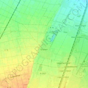
Name: Graben topographic map, elevation, terrain.

Location: Graben, Augsburg (district), Bavaria, Germany (48.17784 10.79683 48.20686 10.87726)

Average elevation: 552 m

Minimum elevation: 536 m

Maximum elevation: 570 m

Other topographic maps

Click on a map to view its topography, its elevation and its terrain.

Erlingen

Germany > Bavaria > Augsburg (district) > Meitingen

Average elevation: 435 m

Gear up for your next adventure:

🕶️Polarized Sunglasses - Reduces glare from snow and water when reading terrain
🎒Backpack Rain Covers - Universal waterproof covers to protect your gear from downpours
👖Hiking Trousers - Durable trousers designed for rough terrain
🌂Windproof Trekking Umbrellas - Surprising but effective rain protection on low-wind trails
Altimeter Watches - Watches measuring altitude for mountain activities

As an Amazon Associate, this site earns from qualifying purchases at no extra cost to you.