Geolocate

Shawnee topographic map

Click on the map to display elevation.

About this map

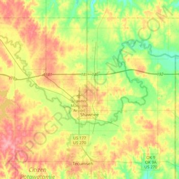
Name: Shawnee topographic map, elevation, terrain.

Location: Shawnee, Pottawatomie County, Oklahoma, United States (35.26064 -97.11646 35.46358 -96.80717)

Average elevation: 316 m

Minimum elevation: 271 m

Maximum elevation: 370 m

Other topographic maps

Click on a map to view its topography, its elevation and its terrain.

Eason

United States > Oklahoma > Pottawatomie County

Average elevation: 327 m

Gear up for your next adventure:

🧭Professional Hiking Compasses - High-precision liquid-filled compasses for map reading and orientation
🧼Technical Clothing Wash - Special soap to clean and restore waterproof membranes
🌂Windproof Trekking Umbrellas - Surprising but effective rain protection on low-wind trails
🦯Walking Poles - Supportive poles for long-distance walking
🎒Replacement Sternum Straps - Repair parts for hiking rucksacks

As an Amazon Associate, this site earns from qualifying purchases at no extra cost to you.