
Gahunga topographic map
Interactive map
Click on the map to display elevation.
About this map
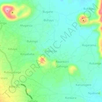
Name: Gahunga topographic map, elevation, terrain.
Location: Gahunga, Cyanika, Kisoro, Western Region, Uganda (-1.33552 29.72422 -1.29552 29.76422)
Average elevation: 1,954 m
Minimum elevation: 1,895 m
Maximum elevation: 2,109 m