
Berhoum topographic map
Interactive map
Click on the map to display elevation.
About this map
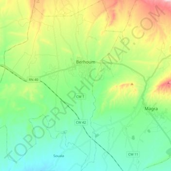
Name: Berhoum topographic map, elevation, terrain.
Location: Berhoum, Magra District, M'Sila, 28130, Algeria (35.56449 4.91629 35.70635 5.07406)
Average elevation: 591 m
Minimum elevation: 459 m
Maximum elevation: 899 m