
Malange topographic map
Interactive map
Click on the map to display elevation.
About this map
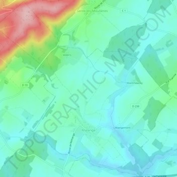
Name: Malange topographic map, elevation, terrain.
Average elevation: 257 m
Minimum elevation: 213 m
Maximum elevation: 396 m
Other topographic maps
Click on a map to view its topography, its elevation and its terrain.
Les Minerais
França > Borgonha-Franco-Condado > Jura > Dampierre > Les Minerais
Les Minerais, Dampierre, Dole, Jura, Borgonha-Franco-Condado, França metropolitana, 39700, França
Average elevation: 253 m