
Thank you for supporting this site ❤️
Make a donation
Make a donation
Gear up for your next adventure:
As an Amazon Associate, this site earns from qualifying purchases at no extra cost to you.
Puthukadau topographic map
Click on the map to display elevation.
Thank you for supporting this site ❤️
Make a donation
Make a donation
Gear up for your next adventure:
As an Amazon Associate, this site earns from qualifying purchases at no extra cost to you.
About this map
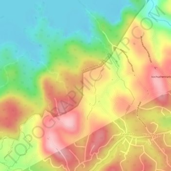
Name: Puthukadau topographic map, elevation, terrain.
Location: Puthukadau, Palakkada, Kanchiyar, Idukki, Kerala, India (9.74279 77.05657 9.76332 77.07525)
Average elevation: 818 m
Minimum elevation: 714 m
Maximum elevation: 912 m
Thank you for supporting this site ❤️
Make a donation
Make a donation
Gear up for your next adventure:
As an Amazon Associate, this site earns from qualifying purchases at no extra cost to you.