
Thank you for supporting this site ❤️
Make a donation
Make a donation
Gear up for your next adventure:
As an Amazon Associate, this site earns from qualifying purchases at no extra cost to you.
Kopparasikoppa topographic map
Click on the map to display elevation.
Thank you for supporting this site ❤️
Make a donation
Make a donation
Gear up for your next adventure:
As an Amazon Associate, this site earns from qualifying purchases at no extra cost to you.
About this map
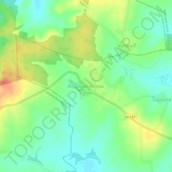
Name: Kopparasikoppa topographic map, elevation, terrain.
Location: Kopparasikoppa, Hanagal taluk, Haveri, Karnataka, India (14.78276 75.05227 14.82276 75.09227)
Average elevation: 596 m
Minimum elevation: 577 m
Maximum elevation: 624 m
Thank you for supporting this site ❤️
Make a donation
Make a donation
Gear up for your next adventure:
As an Amazon Associate, this site earns from qualifying purchases at no extra cost to you.