Geolocate

Jassur topographic map

Click on the map to display elevation.

About this map

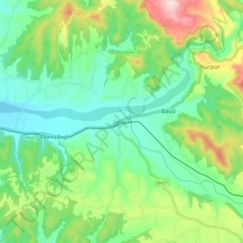
Name: Jassur topographic map, elevation, terrain.

Location: Jassur, Nurpur, Kangra, Himachal Pradesh, 176201, India (32.24162 75.80945 32.32162 75.88945)

Average elevation: 506 m

Minimum elevation: 405 m

Maximum elevation: 729 m

Gear up for your next adventure:

🔦Outdoor Torches - Reliable torches for night navigation
💧Hydration Reservoirs - Convenient water bladders for hands-free drinking on the move
🧣Fleece Neck Warmers - Extra insulation for winter topographic surveys
🥫Expedition Meals - Lightweight, high-calorie nutrition for long-distance hikers
🥾Men's Waterproof Hiking Boots - Durable footwear with deep lugs for muddy and rocky UK terrains

As an Amazon Associate, this site earns from qualifying purchases at no extra cost to you.