
Hartford topographic map
Interactive map
Click on the map to display elevation.
About this map
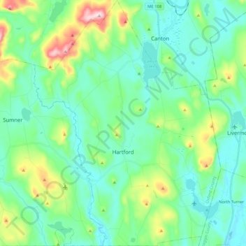
Name: Hartford topographic map, elevation, terrain.
Location: Hartford, Oxford County, Maine, 04220, États-Unis d'Amérique (44.31685 -70.42201 44.46333 -70.26522)
Average elevation: 192 m
Minimum elevation: 100 m
Maximum elevation: 510 m
Other topographic maps
Click on a map to view its topography, its elevation and its terrain.
Paris
États-Unis d'Amérique > Maine > Oxford County > Paris
Paris, Oxford County, Maine, 04281, États-Unis d'Amérique
Average elevation: 207 m