
Walderbach topographic map
Interactive map
Click on the map to display elevation.
About this map
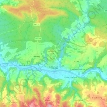
Name: Walderbach topographic map, elevation, terrain.
Average elevation: 426 m
Minimum elevation: 346 m
Maximum elevation: 577 m
Other topographic maps
Click on a map to view its topography, its elevation and its terrain.
Kreuzbach
Deutschland > Bayern > Landkreis Cham
Kreuzbach, Blaibach, Landkreis Cham, Bayern, 93476, Deutschland
Average elevation: 453 m