
Thank you for supporting this site ❤️
Make a donation
Make a donation
Gear up for your next adventure:
As an Amazon Associate, this site earns from qualifying purchases at no extra cost to you.
Sant'Antonio topographic map
Click on the map to display elevation.
Thank you for supporting this site ❤️
Make a donation
Make a donation
Gear up for your next adventure:
As an Amazon Associate, this site earns from qualifying purchases at no extra cost to you.
About this map
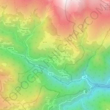
Name: Sant'Antonio topographic map, elevation, terrain.
Location: Sant'Antonio, Ostana, Cuneo, Piemonte, Italia (44.67433 7.17149 44.71433 7.21149)
Average elevation: 1,440 m
Minimum elevation: 806 m
Maximum elevation: 2,181 m
Thank you for supporting this site ❤️
Make a donation
Make a donation
Gear up for your next adventure:
As an Amazon Associate, this site earns from qualifying purchases at no extra cost to you.