
Arciprestazgo de Alcalá Sur topographic map
Interactive map
Click on the map to display elevation.
Arciprestazgo de Alcalá Sur
Standing at an average altitude of 654 m, and occupying some 88 km2; the city was for a long time contained in between the Henares to the South and the Madrid-Barcelona railway to the North. However, the increasing population brought on the sprawl of the urbanised area to the area located in between the railway and the A-2 motorway and beyond.
About this map
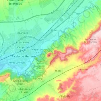
Name: Arciprestazgo de Alcalá Sur topographic map, elevation, terrain.
Average elevation: 685 m
Minimum elevation: 576 m
Maximum elevation: 899 m