
Kęszyca topographic map
Interactive map
Click on the map to display elevation.
About this map
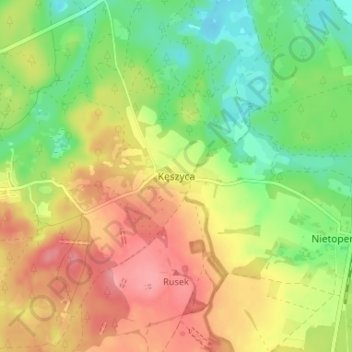
Name: Kęszyca topographic map, elevation, terrain.
Average elevation: 91 m
Minimum elevation: 47 m
Maximum elevation: 137 m
Other topographic maps
Click on a map to view its topography, its elevation and its terrain.
Międzyrzecz
Poland > Lubusz Voivodeship > Międzyrzecz County
Międzyrzecz, gmina Międzyrzecz, Międzyrzecz County, Lubusz Voivodeship, 66-300, Poland
Average elevation: 52 m