
Svínoy topographic map
Interactive map
Click on the map to display elevation.
About this map
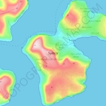
Name: Svínoy topographic map, elevation, terrain.
Location: Svínoy, Norðoya sýsla, 765, Islas Feroe (62.23342 -6.41630 62.30536 -6.28378)
Average elevation: 129 m
Minimum elevation: -6 m
Maximum elevation: 584 m