
Falkenacker topographic map
Interactive map
Click on the map to display elevation.
About this map
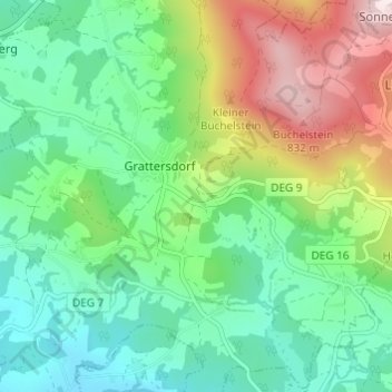
Name: Falkenacker topographic map, elevation, terrain.
Average elevation: 510 m
Minimum elevation: 333 m
Maximum elevation: 891 m
Other topographic maps
Click on a map to view its topography, its elevation and its terrain.
Roggersing
Deutschland > Bayern > Landkreis Deggendorf > Grattersdorf
Roggersing, Grattersdorf, Lalling (VGem), Landkreis Deggendorf, Bayern, 94541, Deutschland
Average elevation: 414 m