
Flaach topographic map
Interactive map
Click on the map to display elevation.
About this map
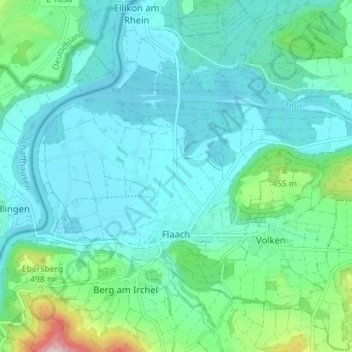
Name: Flaach topographic map, elevation, terrain.
Location: Flaach, Bezirk Andelfingen, Zürich, Schweiz (47.56793 8.57201 47.59861 8.64266)
Average elevation: 393 m
Minimum elevation: 339 m
Maximum elevation: 640 m
Other topographic maps
Click on a map to view its topography, its elevation and its terrain.
Rheinau
Schweiz > Zürich > Bezirk Andelfingen
Rheinau, Bezirk Andelfingen, Zürich, 8462, Schweiz
Average elevation: 397 m