
Fischbach topographic map
Interactive map
Click on the map to display elevation.
About this map
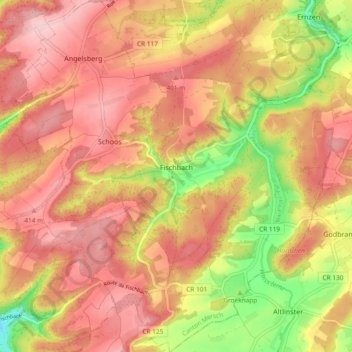
Name: Fischbach topographic map, elevation, terrain.
Location: Fischbach, Canton Mersch, Luxembourg (49.71458 6.14170 49.77475 6.22829)
Average elevation: 362 m
Minimum elevation: 247 m
Maximum elevation: 431 m
Other topographic maps
Click on a map to view its topography, its elevation and its terrain.