
Thank you for supporting this site ❤️
Make a donation
Make a donation
Gear up for your next adventure:
As an Amazon Associate, this site earns from qualifying purchases at no extra cost to you.
Bodskatan topographic map
Click on the map to display elevation.
Thank you for supporting this site ❤️
Make a donation
Make a donation
Gear up for your next adventure:
As an Amazon Associate, this site earns from qualifying purchases at no extra cost to you.
About this map
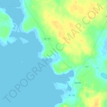
Name: Bodskatan topographic map, elevation, terrain.
Location: Bodskatan, Storön, Kalix kommun, Norrbotten County, Sweden (65.72671 23.05508 65.76671 23.09508)
Average elevation: 7 m
Minimum elevation: -2 m
Maximum elevation: 24 m
Thank you for supporting this site ❤️
Make a donation
Make a donation
Gear up for your next adventure:
As an Amazon Associate, this site earns from qualifying purchases at no extra cost to you.