
Gurp topographic map
Interactive map
Click on the map to display elevation.
About this map
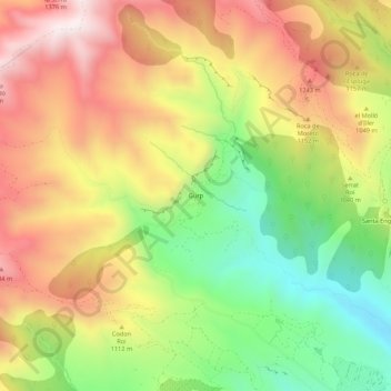
Name: Gurp topographic map, elevation, terrain.
Average elevation: 1,026 m
Minimum elevation: 623 m
Maximum elevation: 1,422 m
Other topographic maps
Click on a map to view its topography, its elevation and its terrain.
la Torre de Tamúrcia
Espagne > Catalogne > Pallars-Inférieur > Tremp
la Torre de Tamúrcia, Tremp, Pallars-Inférieur, Lérida, Catalogne, 22583, Espagne
Average elevation: 1,000 m