
昔阳县 topographic map
Interactive map
Click on the map to display elevation.
About this map
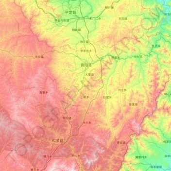
Name: 昔阳县 topographic map, elevation, terrain.
Location: 昔阳县, 晋中市, 山西省, 中国 (37.32854 113.32791 37.72880 114.13303)
Average elevation: 1,145 m
Minimum elevation: 365 m
Maximum elevation: 1,979 m
Other topographic maps
Click on a map to view its topography, its elevation and its terrain.