
Peguera topographic map
Interactive map
Click on the map to display elevation.
About this map
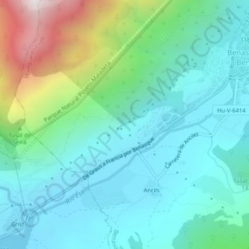
Name: Peguera topographic map, elevation, terrain.
Location: Peguera, Benasque, La Ribagorza, Huesca, Aragon, 22440, Espagne (42.58793 0.49561 42.60793 0.51561)
Average elevation: 1,353 m
Minimum elevation: 1,077 m
Maximum elevation: 2,274 m
Other topographic maps
Click on a map to view its topography, its elevation and its terrain.