
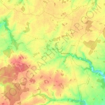
Monthodon topographic map
Interactive map
Click on the map to display elevation.
About this map
Name: Monthodon topographic map, elevation, terrain.
Average elevation: 148 m
Minimum elevation: 109 m
Maximum elevation: 173 m
Other topographic maps
Click on a map to view its topography, its elevation and its terrain.
La Petite Suisse
Frankreich > Zentrum-Loiretal > Indre-et-Loire > Château-la-Vallière
La Petite Suisse, Château-la-Vallière, Chinon, Indre-et-Loire, Zentrum-Loiretal, Metropolitanes Frankreich, 37330, Frankreich
Average elevation: 88 m
Saint-Antoine-du-Rocher
Frankreich > Zentrum-Loiretal > Indre-et-Loire > Saint-Antoine-du-Rocher
Saint-Antoine-du-Rocher, Chinon, Indre-et-Loire, Zentrum-Loiretal, Metropolitanes Frankreich, 37360, Frankreich
Average elevation: 106 m