Geolocate

Fletcher Hills topographic map

Click on the map to display elevation.

About this map

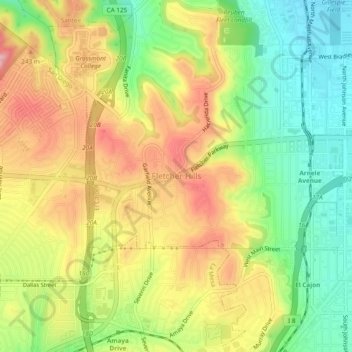
Name: Fletcher Hills topographic map, elevation, terrain.

Location: Fletcher Hills, El Cajon, San Diego County, California, 92020, United States (32.78327 -117.01383 32.82327 -116.97383)

Average elevation: 189 m

Minimum elevation: 111 m

Maximum elevation: 273 m

Other topographic maps

Click on a map to view its topography, its elevation and its terrain.

Gear up for your next adventure:

🔋Power Banks - Portable chargers for long outdoor trips
🪢Paracord - Multi-purpose cord for camping and survival
🛌Sleeping Mats - Insulated mats for comfortable outdoor sleeping
🥾Trekking Poles - Poles to improve stability on uneven terrain
🌂Windproof Trekking Umbrellas - Surprising but effective rain protection on low-wind trails

As an Amazon Associate, this site earns from qualifying purchases at no extra cost to you.