
Thank you for supporting this site ❤️
Make a donation
Make a donation
Gear up for your next adventure:
As an Amazon Associate, this site earns from qualifying purchases at no extra cost to you.
Duxeralm topographic map
Click on the map to display elevation.
Thank you for supporting this site ❤️
Make a donation
Make a donation
Gear up for your next adventure:
As an Amazon Associate, this site earns from qualifying purchases at no extra cost to you.
About this map
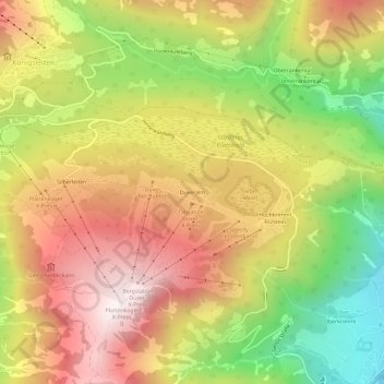
Name: Duxeralm topographic map, elevation, terrain.
Location: Duxeralm, Krimml, Bezirk Zell am See, Salzburg, 5743, Austria (47.21572 12.12496 47.25572 12.16496)
Average elevation: 1,563 m
Minimum elevation: 1,033 m
Maximum elevation: 2,031 m
Thank you for supporting this site ❤️
Make a donation
Make a donation
Gear up for your next adventure:
As an Amazon Associate, this site earns from qualifying purchases at no extra cost to you.