Geolocate

Berg topographic map

Click on the map to display elevation.

About this map

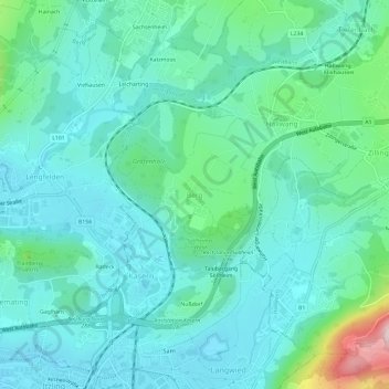
Name: Berg topographic map, elevation, terrain.

Location: Berg, Hallwang, Bezirk Salzburg-Umgebung, Salzburg, 5300, Austria (47.82386 13.04965 47.86386 13.08965)

Average elevation: 489 m

Minimum elevation: 417 m

Maximum elevation: 797 m

Other topographic maps

Click on a map to view its topography, its elevation and its terrain.

Koppl

Austria > Salzburg > Bezirk Salzburg-Umgebung

Average elevation: 737 m

Thalgau

Austria > Salzburg > Bezirk Salzburg-Umgebung

Average elevation: 704 m

Anif

Austria > Salzburg > Bezirk Salzburg-Umgebung

Average elevation: 443 m

Faistenau

Austria > Salzburg > Bezirk Salzburg-Umgebung

Average elevation: 875 m

Hintersee

Austria > Salzburg > Bezirk Salzburg-Umgebung

Average elevation: 1,117 m

Hintersee

Austria > Salzburg > Bezirk Salzburg-Umgebung

Average elevation: 1,117 m

Mattsee

Austria > Salzburg > Bezirk Salzburg-Umgebung

Average elevation: 562 m

Gear up for your next adventure:

🥾Trekking Poles - Poles to improve stability on uneven terrain
🕶️Polarized Sunglasses - Reduces glare from snow and water when reading terrain
🗺️Ordnance Survey Maps - Official UK maps for walking and outdoor activities
🌄Compact Monoculars - Lightweight optics for hiking
🍲Portable Camping Stoves - Fast-boiling stoves for hot meals on remote topographic survey trips

As an Amazon Associate, this site earns from qualifying purchases at no extra cost to you.