
Philippshütten topographic map
Interactive map
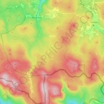
Click on the map to display elevation.
About this map
Name: Philippshütten topographic map, elevation, terrain.
Average elevation: 1,140 m
Minimum elevation: 890 m
Maximum elevation: 1,377 m
Other topographic maps
Click on a map to view its topography, its elevation and its terrain.
Šumava
Tschechien > Südwesten > Pilsner Region > Mader
Šumava, Mader, Bezirk Klattau, Pilsner Region, Südwesten, Tschechien
Average elevation: 1,154 m