
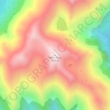
White Peak topographic map
Interactive map
Click on the map to display elevation.
About this map
Name: White Peak topographic map, elevation, terrain.
Average elevation: 1,153 m
Minimum elevation: 619 m
Maximum elevation: 1,564 m
Other topographic maps
Click on a map to view its topography, its elevation and its terrain.
Merrivale
New Zealand > Southland > Southland District > Tuatapere Te Waewae Community
Merrivale, Tuatapere Te Waewae Community, Southland District, Southland, New Zealand
Average elevation: 192 m
The Downs
New Zealand > Southland > Southland District > Tuatapere Te Waewae Community
The Downs, Tuatapere Te Waewae Community, Southland District, Southland, New Zealand
Average elevation: 34 m
Blackmount
New Zealand > Southland > Southland District > Tuatapere Te Waewae Community > Blackmount
Blackmount, Tuatapere Te Waewae Community, Southland District, Southland, New Zealand
Average elevation: 170 m