
Winkl topographic map
Interactive map
Click on the map to display elevation.
About this map
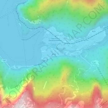
Name: Winkl topographic map, elevation, terrain.
Location: Winkl, Obertraun, Bezirk Gmunden, Upper Austria, 4831, Austria (47.53104 13.66292 47.57104 13.70292)
Average elevation: 829 m
Minimum elevation: 498 m
Maximum elevation: 1,755 m
Other topographic maps
Click on a map to view its topography, its elevation and its terrain.
Krippenstein
Austria > Upper Austria > Bezirk Gmunden > Obertraun
Krippenstein, Obertraun, Bezirk Gmunden, Upper Austria, 4831, Austria
Average elevation: 1,728 m