
Alt-Marl topographic map
Interactive map
Click on the map to display elevation.
About this map
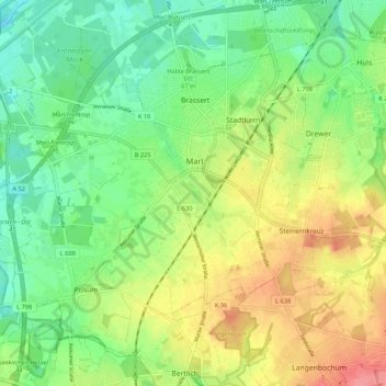
Name: Alt-Marl topographic map, elevation, terrain.
Average elevation: 60 m
Minimum elevation: 29 m
Maximum elevation: 103 m
Other topographic maps
Click on a map to view its topography, its elevation and its terrain.
Sickingmühle
Deutschland > Nordrhein-Westfalen > Kreis Recklinghausen > Marl
Sickingmühle, Marl, Kreis Recklinghausen, Nordrhein-Westfalen, 45772, Deutschland
Average elevation: 40 m
Polsum
Deutschland > Nordrhein-Westfalen > Kreis Recklinghausen > Marl
Polsum, Marl, Kreis Recklinghausen, Nordrhein-Westfalen, 45896, Deutschland
Average elevation: 56 m