
Thank you for supporting this site ❤️
Make a donation
Make a donation
Gear up for your next adventure:
As an Amazon Associate, this site earns from qualifying purchases at no extra cost to you.
Kyperounta topographic map
Click on the map to display elevation.
Thank you for supporting this site ❤️
Make a donation
Make a donation
Gear up for your next adventure:
As an Amazon Associate, this site earns from qualifying purchases at no extra cost to you.
About this map
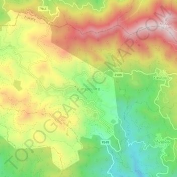
Name: Kyperounta topographic map, elevation, terrain.
Location: Kyperounta, Limassol District, Cyprus, 4876, Cyprus (34.92119 32.95425 34.96119 32.99425)
Average elevation: 1,235 m
Minimum elevation: 894 m
Maximum elevation: 1,602 m
Thank you for supporting this site ❤️
Make a donation
Make a donation
Gear up for your next adventure:
As an Amazon Associate, this site earns from qualifying purchases at no extra cost to you.