
Moujpur topographic map
Interactive map
Click on the map to display elevation.
About this map
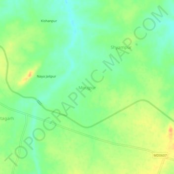
Name: Moujpur topographic map, elevation, terrain.
Average elevation: 262 m
Minimum elevation: 245 m
Maximum elevation: 283 m
Other topographic maps
Click on a map to view its topography, its elevation and its terrain.
Magrauni
India > Madhya Pradesh > Narwar Tahsil
Magrauni, Narwar Tahsil, Shivpuri District, Madhya Pradesh, 473865, India
Average elevation: 261 m
Saboli
India > Madhya Pradesh > Narwar Tahsil
Saboli, Narwar Tahsil, Shivpuri district, Madhya Pradesh, India
Average elevation: 253 m