Geolocate

Woodlands - Farm topographic map

Interactive map

Click on the map to display elevation.

About this map

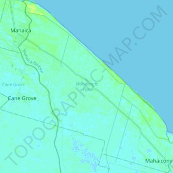
Name: Woodlands - Farm topographic map, elevation, terrain.

Location: Woodlands - Farm, Mahaica-Berbice, Guyana (6.56240 -57.92509 6.70752 -57.79136)

Average elevation: 2 m

Minimum elevation: -2 m

Maximum elevation: 13 m

Other topographic maps

Click on a map to view its topography, its elevation and its terrain.

Armadale

Guyana > Mahaica-Berbice > Union - Naarstigheid > Bush Lot

Armadale, Bush Lot, Naarstigheid-Union Local Government District, Union - Naarstigheid, Mahaica-Berbice, Guyana

Average elevation: 2 m

Seafield

Guyana > Mahaica-Berbice > Seafield

Seafield, Mahaica-Berbice Region, Mahaica-Berbice, Guyana

Average elevation: 2 m

Broomlands

Guyana > Mahaica-Berbice > Broomlands

Broomlands, Mahaica-Berbice Region, Mahaica-Berbice, Guyana

Average elevation: 2 m