Geolocate

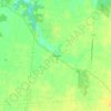
Georgetown topographic map

Click on the map to display elevation.

About this map

Name: Georgetown topographic map, elevation, terrain.

Location: Georgetown, Pleasant Township, Brown County, Ohio, United States (38.83950 -83.91765 38.90015 -83.87820)

Average elevation: 272 m

Minimum elevation: 168 m

Maximum elevation: 311 m

Other topographic maps

Click on a map to view its topography, its elevation and its terrain.

Feesburg

United States > Ohio > Brown County

Average elevation: 280 m

Chasetown

United States > Ohio > Brown County

Average elevation: 288 m

Yankeetown

United States > Ohio > Brown County

Average elevation: 284 m

Gear up for your next adventure:

🥤Hiking Water Bottles - Reusable bottles for hydration on the trail
📦Dry Bags - Waterproof bags to protect gear from rain
🎒Hiking Backpacks - Comfortable backpacks for day hikes and multi-day treks
🧺Microfibre Travel Towels - Fast-drying and compact towels for wild swimming and camping
🦶Anti-Blister Balms - Protect your feet before long topographic expeditions

As an Amazon Associate, this site earns from qualifying purchases at no extra cost to you.