
Riedholz topographic map
Interactive map
Click on the map to display elevation.
About this map
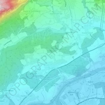
Name: Riedholz topographic map, elevation, terrain.
Average elevation: 532 m
Minimum elevation: 418 m
Maximum elevation: 1,253 m
Other topographic maps
Click on a map to view its topography, its elevation and its terrain.
Günsberg
Schweiz > Solothurn > Amtei Solothurn-Lebern
Günsberg, Bezirk Lebern, Amtei Solothurn-Lebern, Solothurn, 4524, Schweiz
Average elevation: 785 m