
Sakri topographic map
Interactive map
Click on the map to display elevation.
About this map
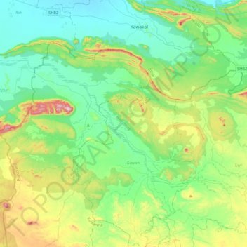
Name: Sakri topographic map, elevation, terrain.
Location: Sakri, Gawan, Giridih, Jharkhand, 825132, India (24.59827 85.65397 24.79365 86.06902)
Average elevation: 228 m
Minimum elevation: 79 m
Maximum elevation: 656 m