Geolocate

Charleston topographic map

Click on the map to display elevation.

About this map

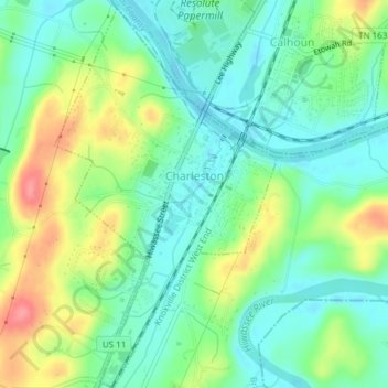
Name: Charleston topographic map, elevation, terrain.

Location: Charleston, Bradley County, Tennessee, United States (35.26896 -84.77116 35.29974 -84.74951)

Average elevation: 234 m

Minimum elevation: 206 m

Maximum elevation: 288 m

Other topographic maps

Click on a map to view its topography, its elevation and its terrain.

McDonald

United States > Tennessee > Bradley County

Average elevation: 269 m

Hickory Hills

United States > Tennessee > Bradley County

Average elevation: 257 m

Climer

United States > Tennessee > Bradley County

Average elevation: 255 m

Eureka

United States > Tennessee > Bradley County

Average elevation: 237 m

Etola

United States > Tennessee > Bradley County

Average elevation: 252 m

Mount Harmony

United States > Tennessee > Bradley County

Average elevation: 235 m

Gear up for your next adventure:

🧵Survival Paracord - Multi-purpose cordage for emergency repairs and shelters
🧴Tick Removal Tools - Small, essential health tool for UK woodland and moorland
💧Hydration Reservoirs - Convenient water bladders for hands-free drinking on the move
👟Men's Trail Running Shoes - Lightweight grip for fast movement over topographic contours
🥤Collapsible Water Bottles - Save space in your rucksack as you consume your water

As an Amazon Associate, this site earns from qualifying purchases at no extra cost to you.