
下宝丰村 topographic map
Interactive map
Click on the map to display elevation.
About this map
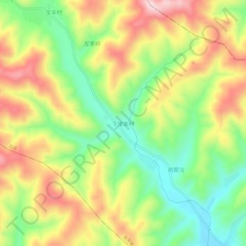
Name: 下宝丰村 topographic map, elevation, terrain.
Location: 下宝丰村, 北平镇, 古县, 临汾市, 山西省, 中国 (36.48627 112.09996 36.52627 112.13996)
Average elevation: 1,288 m
Minimum elevation: 1,143 m
Maximum elevation: 1,454 m