Geolocate

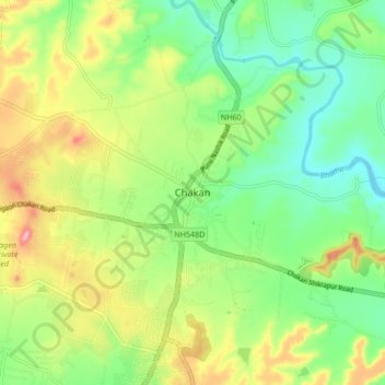
Chakan topographic map

Click on the map to display elevation.

Chakan

Shiroli Chandus village, located 6 km north of Chakan, had been identified as the probable site for the proposed Pune International Airport, but due to the protests by the villagers & uneven topography, the site has been shifted to Purandar.

Wikipedia (CC-BY-SA 3.0)

About this map

Name: Chakan topographic map, elevation, terrain.

Location: Chakan, Khed, Pune, Maharashtra, 410500, India (18.72231 73.82254 18.80231 73.90254)

Average elevation: 624 m

Minimum elevation: 568 m

Maximum elevation: 712 m

Gear up for your next adventure:

🧼Technical Clothing Wash - Special soap to clean and restore waterproof membranes
🕶️Glacier Goggles - Maximum protection for high-altitude snow topography
🔦Waterproof LED Headlamps - Hands-free lighting for evening treks and emergency navigation
🧴Sport Sunscreen Sticks - High-protection sunblock that won't run into your eyes on the trail
👕Merino Base Layers - Natural temperature regulation for cold weather hiking and camping

As an Amazon Associate, this site earns from qualifying purchases at no extra cost to you.