
Nanjri topographic map
Interactive map
Click on the map to display elevation.
About this map
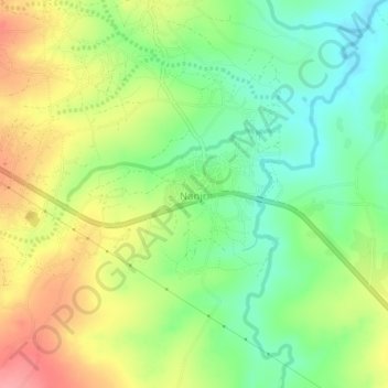
Name: Nanjri topographic map, elevation, terrain.
Location: Nanjri, Lilongwe, Central Region, Malawi, Malawi (-14.09183 33.81473 -14.05183 33.85473)
Average elevation: 1,078 m
Minimum elevation: 1,037 m
Maximum elevation: 1,129 m
Other topographic maps
Click on a map to view its topography, its elevation and its terrain.