
Goun-dong topographic map
Interactive map
Click on the map to display elevation.
About this map
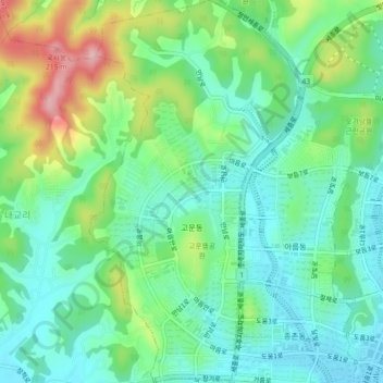
Name: Goun-dong topographic map, elevation, terrain.
Location: Goun-dong, Sejong, South Korea (36.49934 127.22365 36.53528 127.24866)
Average elevation: 79 m
Minimum elevation: 24 m
Maximum elevation: 204 m
Other topographic maps
Click on a map to view its topography, its elevation and its terrain.
Eojin-dong
South Korea > Sejong > Eojin-dong
Eojin-dong, Dodam-dong, Sejong, South Korea
Average elevation: 40 m
Jochiwon-eup
South Korea > Sejong > Jochiwon-eup
Jochiwon-eup, Sejong, South Korea
Average elevation: 49 m
Yeongi-myeon
South Korea > Sejong > Yeongi-myeon
Yeongi-myeon, Sejong, South Korea
Average elevation: 63 m