
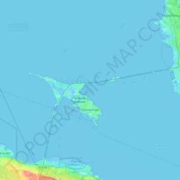
Kronstadt topographic map
Interactive map
Click on the map to display elevation.
About this map
Name: Kronstadt topographic map, elevation, terrain.
Average elevation: 2 m
Minimum elevation: -10 m
Maximum elevation: 73 m
The Kronstadt tide gauge is situated near the former Italian palace. Sea level observations in Saint Petersburg began already in 1703. On Kotlin Island, the main naval fortress of the Russian Empire began observations in 1707. This monitoring was necessary because the water level of the Finnish Gulf could change considerably in a short time, creating problems for shipping. The annual flood also required close monitoring of the water level. The Kronstadt sea-gauge with the tide gauge pavilion is the zero level of the Baltic system of highs and lows. All depths and altitudes (even the heights of spacecraft) in Russia and some other countries of the former Russian Empire are measured according to the Kronstadt sea-gauge. Yuri Gagarin, the first man in space, said in 1967 that it was "the Hub of the Universe".
Other topographic maps
Click on a map to view its topography, its elevation and its terrain.
Saint Petersburg
Saint Petersburg, Northwestern Federal District, Russia
Average elevation: 17 m
Невский округ
Russia > Saint Petersburg > Saint Petersburg
Невский округ, Saint Petersburg, Northwestern Federal District, Russia
Average elevation: 10 m
Krasnoye Selo
Krasnoye Selo, Saint Petersburg, Northwestern Federal District, 198320, Russia
Average elevation: 97 m
Peterhof
Peterhof, Saint Petersburg, Northwestern Federal District, Russia
Average elevation: 21 m
Neva River
Russia > Saint Petersburg > Saint Petersburg
Neva River, Saint Petersburg, Northwestern Federal District, 190000, Russia
Average elevation: 25 m
Lomonosov
Lomonosov, Saint Petersburg, Northwestern Federal District, Russia
Average elevation: 23 m
Saint Petersburg
Russia > Saint Petersburg > Saint Petersburg
Saint Petersburg, Northwestern Federal District, 191186, Russia
Average elevation: 14 m
Peter and Paul Fortress
Russia > Saint Petersburg > Saint Petersburg
Peter and Paul Fortress, Западный Артиллерийский мост, Petrograd Side, округ Кронверкское, Saint Petersburg, Northwestern Federal District, 197101, Russia
Average elevation: 7 m
округ Звёздное
Russia > Saint Petersburg > округ Звёздное
округ Звёздное, Московский район, Saint Petersburg, Northwestern Federal District, 190000, Russia
Average elevation: 16 m
округ Пулковский меридиан
Russia > Saint Petersburg > округ Пулковский меридиан
округ Пулковский меридиан, Московский район, Saint Petersburg, Northwestern Federal District, 190000, Russia
Average elevation: 27 m
Palace District
Russia > Saint Petersburg > Palace District
Palace District, Центральный район, Saint Petersburg, Northwestern Federal District, 190000, Russia
Average elevation: 8 m
Pushkin
Pushkin, Saint Petersburg, Northwestern Federal District, Russia
Average elevation: 48 m
округ Измайловское
Russia > Saint Petersburg > округ Измайловское
округ Измайловское, Адмиралтейский район, Saint Petersburg, Northwestern Federal District, 190000, Russia
Average elevation: 8 m