
Napol’nyye Vyselki topographic map
Interactive map
Click on the map to display elevation.
About this map
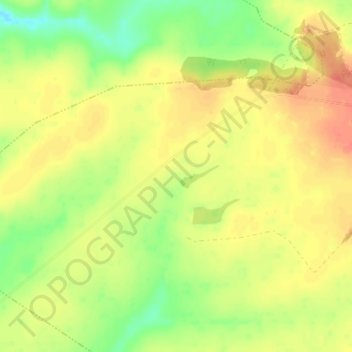
Name: Napol’nyye Vyselki topographic map, elevation, terrain.
Average elevation: 206 m
Minimum elevation: 180 m
Maximum elevation: 226 m
Other topographic maps
Click on a map to view its topography, its elevation and its terrain.
Грязновское сельское поселение
Russia > Ryazan Oblast > Mikhaylovsky District
Грязновское сельское поселение, Mikhaylovsky District, Ryazan Oblast, Central Federal District, 391731, Russia
Average elevation: 190 m