
Les Combes topographic map
Interactive map
Click on the map to display elevation.
About this map
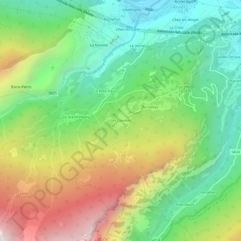
Name: Les Combes topographic map, elevation, terrain.
Location: Les Combes, Introd, Valle d'Aosta, 11011, Italia (45.66360 7.13254 45.70360 7.17254)
Average elevation: 1,300 m
Minimum elevation: 696 m
Maximum elevation: 2,281 m